

-
Guide to Nantahala National Forest
Slider Caption
Book Now
Guide to Nantahala National Forest
Nantahala National Forest is North Carolina's largest national forest, covering over 531,000 acres of the state’s southwest corner. It's also the second wettest region in the United States, averaging close to 50 inches of rainfall a year. The forest is characterized by deep valleys and gorges, and much of the forest floor only gets sunlight during mid-day. Elevation ranges from 1,200 feet along the Tusquitee River to 5,800 feet at Lone Bald. Nantahala National Forest contains parts of three massive wilderness areas and is home to a number of major trails, scenic lakes, and majestic waterfalls. Because of its size, the forest is divided into three ranger districts.
Wilderness Areas
Three wilderness areas are part of Nantahala National Forest.
- Ellicott Rock Wilderness
- Southern Nantahala Wilderness
- Joyce Kilmer-Slickrock Wilderness
Ellicott Rock Wilderness is located where North Carolina, South Carolina, and Georgia meet, at the southern tip of the Blue Ridge Mountains. The wilderness area spans 8,274 acres, with almost 3,400 acres located in Nantahala National Forest. The area is characterized by dense hardwood forests and very rugged terrain.
Southern Nantahala Wilderness covers 23,365 acres on the North Carolina and Georgia border, with over 11,700 acres in the Nantahala National Forest. This wilderness area is known for its steep mountains and strenuous trails, including over 30 miles of the Appalachian Trail.
Joyce Kilmer-Slickrock Wilderness is a massive 17,394-acre area that runs from western North Carolina into eastern Tennessee. The area is home to Joyce Kilmer Memorial Forest and to Slickrock Creek Trail, one of the country's most difficult hiking trails.
Hiking Trails
Two major hiking trails that run through the Nantahala National Forest are the Appalachian Trail and the Bartram Trail. The section of the Appalachian Trail in the forest starts near the Nantahala River and goes to the Georgia border. The Bartram Trail also has a section that starts around the Nantahala River. It then travels upward over 3,000 feet to the top of Cheoah Bald.
Popular trails in our part of Nantahala National Forest are Bartram Trail’s Wallace Branch to William’s Pulpit, Wayah Bald via Appalachian Trail, and Wesser Bald Fire Tower via Appalachian Trail.
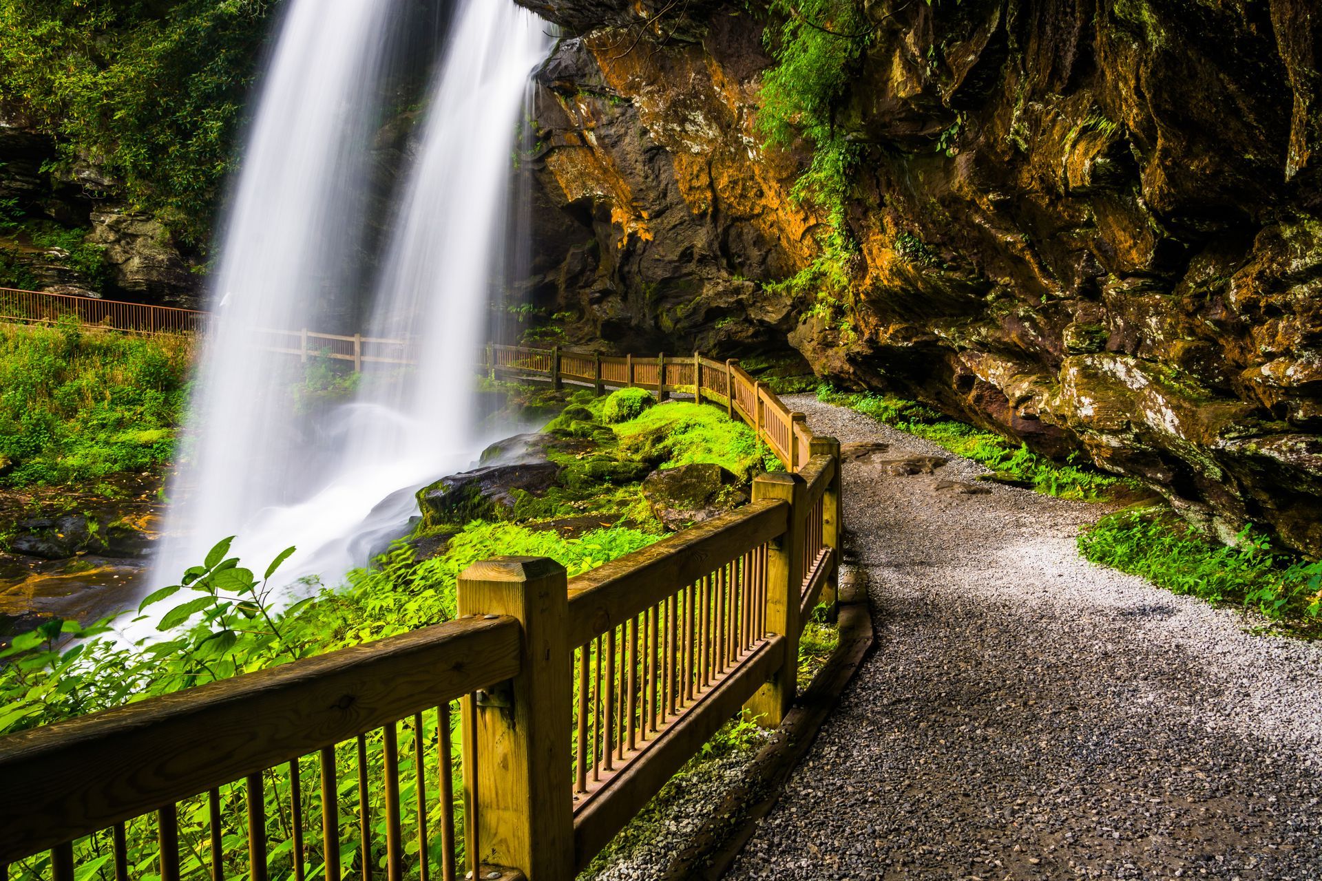
Waterfalls
Nantahala National Forest is filled with stunning waterfalls, including the following.
- Glen Falls
- Bridal Veil Falls
- Schoolhouse Falls
However, Whitewater Falls is arguably the most impressive of all the forest’s waterfalls. This upper portion of this cascading waterfall drops 411 feet, making it the highest waterfall east of the Rockies. After that, the lower section drops another 400 feet, ending up in South Carolina.
If you’re wanting to visit an impressive waterfall closer to us, try Rufus Morgan Falls. This 70-foot waterfall is a short drive away, just west of Franklin, North Carolina.
Lakes
Nantahala National Forest has 15 beautiful lakes. Two of the most popular lakes, Nantahala Lake and Santeetlah Lake, are close to us. Nantahala Lake features crystal clear waters, 42 miles of shoreline, and some of the best fishing in North Carolina. Santeetlah Lake, near Robbinsville, North Carolina, is considered one of the most beautiful lakes in the country. This pristine, unspoiled lake covers about 3,000 acres and has 76 miles of shoreline. It’s a great place to enjoy kayaking, canoeing, and fishing,
Ranger Districts
Nantahala National Forest has three ranger districts.
- Tusquitee Ranger District
- Nantahala Ranger District
- Cheoah Ranger District
Tusquitee Ranger District, located mainly in Clay and Cherokee counties, is Nantahala National Forest’s western-most district. It’s responsible for the Southern Nantahala Wilderness and is home to the Valley River Mountains. The district’s headquarters are in Murphy, North Carolina.
Nantahala Ranger District is the largest of the three districts, stretching across Macon, Jackson and Swain counties. Prominent locations in this district are Nantahala Gorge and Wayah Bald.
It’s headquartered in Franklin, North Carolina.
Cheoah Ranger District, located in Graham and Swain Counties, contains four mountain reservoirs, dozens of mountain peaks, numerous streams, and hundreds of miles of hiking trails. This district is home to Joyce Kilmer Memorial Forest and the Cherohala Skyway. The district’s headquarters are in Robbinsville, North Carolina.
All Rights Reserved | Cherokee Mountain Cabins
Website Design & Reservation Software by Resnexus